Leprechaun Cave | explore Leprechaun Cave online |
article and photographs by Curvin Metzler |
Leprechaun is a beautiful little mile long cave with some unique formations, hidden in the Wrangell Mountains of southcentral Alaska. A detailed description of the cave follows, but first it may be useful to give some background information, to set the region and some events to scale in space and time. This involves describing the size and geologic context of Alaska in general and the Wrangell Mountains in specific, as well as giving a brief history of the exploration for, and the discovery of, both minerals and caves in the local region of interest.
Alaska's major mountain ranges include the Brooks Range (north of the Arctic Circle), the Saint Elias Range (highest coastal mountains in the world), and the Alaska Range (extending from the Alaska Peninsula to the Canadian border). The latter includes Mount McKinley, known to Alaskans as Denali (the Great One), the highest peak in North America at 20,320 feet (6194 meters). The Wrangell Saint Elias National Park, the largest park in the country, with over 13 million acres (over 5 million hectares), includes nine of the sixteen highest peaks in the United States, many being active volcanoes. Combined with its Canadian counterpart, the Kluane National Park of the Yukon Territory, these lands form the world's largest protected land area, and were chosen as the first international World Heritage site. Within the parklands lie the second and fourth highest peaks of North America, Mount Logan at 19,850 feet (6050 meters) and Mount Saint Elias at 18,008 feet (5489 meters).
Alaska is the largest state in the Union, with its area of 586,000 square miles (1.5 million square kilometers) being slightly over twice that of Texas, the next largest state. If one were to explore an area of 100 miles by 100 miles (160 kilometers by 160 kilometers) every year, it would take almost 60 years to cover the entire state. For most of Alaska, winter lasts half a year, is cold and dark, with the ground mostly frozen and covered with snow, so exploration probably needs to take place during the best four of the remaining months. And though Alaska has quite a bit of carbonate rock, most is very remote--so it should be no surprise that these regions have barely (if ever) been searched for caves.
Some of Alaska's first explored limestone caves Alaska were not known to cavers until the late 1970s, and only a handful of its remote caving regions have been visited more than once. On Prince of Wales Island, Alaska's most visited caving region, the longest known cave, El Capitan Cave, is over 2 miles (3 kilometers) in length. For a short time in the early 1990s, the same island held the record deepest vertical shaft in the United States, El Capitan Pit, dropping 598 feet (182 meters). In the Wrangell Mountains, Whispering Cave was reported in 1996 to be 1.4 miles (2.2 kilometers) in length. Unconfirmed reports say its length has been pushed to over 2 miles (3 kilometers), making it possibly the longest known cave in Alaska.
Most of the contiguous United States, along with Canada and Mexico, together make up one large nucleus of continental crust which has been a stable unit for a very long time--the North American Craton. Alaska, however, is very different in that less than one percent of its surface area belongs to this craton! The remainder is a collage of geologically distinct fragments, separated by fault systems, all brought in from elsewhere by tectonics, the movements of earth's crustal plates. These fragments are called terranes; they differ in size, shape, origin, developmental history, and component rock characteristics. In southern Alaska, the motion of the Pacific plate acts like a conveyor belt in transporting these exotic pieces northward and welding them onto the continent, a process known as tectonic accretion.
A critical unit in establishing the science of accretionary terranes, and the first terrane to receive name recognition, was Wrangellia. It was long known from fossil remains and stratigraphy that Wrangellia had originated from much farther south. In the mid 1970s, paleomagnetic data was published on the 230 million year old Triassic basalts of the Nikolai Greenstone, a major constituent of Wrangellia. Presented was quantitative evidence that Wrangellia had indeed been displaced thousands of miles northward from its origin near the Triassic equator. The analysis determined an original latitude at least 27 degrees farther south than had been predicted and a poleward displacement of 1800 miles (2900 kilometers) relative to the North American Craton. After collecting data and calculating displacements, many other Alaskan terranes were also traced back to their lower latitude roots.
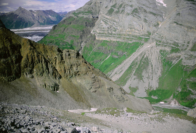
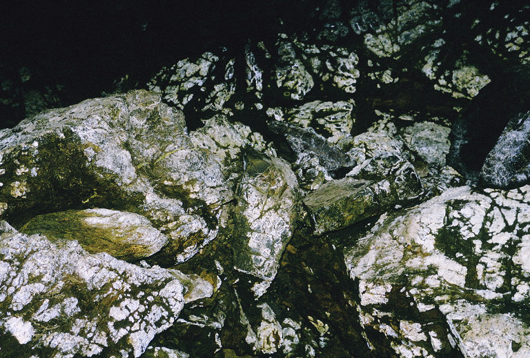
The Wrangellia terrane forms the largest portion of the Wrangell Mountains, and currently lies at about 62 degrees north in latitude. Its most characteristic rocks are exposed nearly continuously in the ridges surrounding the Kennicott and Root Glaciers, and in the canyons along the Chitistone and Nizina Rivers. Here the three strata called the "Triassic Trinity" are distinctively visible: the lower maroon weathering Nikolai Greenstone, the middle light gray weathering Chitistone Limestone, and the upper dark gray weathering Nizina Limestone (Fig. 1).
The Nikolai Greenstone is made of Triassic basalt flows with an aggregate thickness of nearly 10,000 feet (3000 meters). It formed in a vast volcanic field, remnants of which surround the Wrangell Mountains and span at least 625 miles (1000 kilometers), from Haines to the Alaska Peninsula. Extruded over an 8 million year interval, volume calculations for the Nikolai Greenstone are 60,000 cubic miles (275,000 cubic kilometers), enough to bury an area the size of Oregon with over 0.6 mile (1 kilometer) of basalt!
Overlying the Nikolai Greenstone is up to 3600 feet (1100 meters) of Upper Triassic limestone and dolomite (the combined Chitistone and Nizina Limestones), thickest in the Kennicott and Chitistone areas. The lowest parts near McCarthy contain evaporite relicts, stromatolites, and algal mat chips, indicating deposition in an evaporative tidal flat environment near the equator, similar to the Persian Gulf of today. Moving upward in the strata corresponds with deposition in progressively deepening seawater, ending with the muddy limestone and shale of the overlying McCarthy Formation.
The contact between the greenstone and limestone, easily visible from a distance, was important to prospectors who learned that copper ore bodies were located nearby. By 1905, the entire contact zone had been examined and all known major copper deposits had been staked. Since limestone is permeable whereas greenstone is not, groundwater finding its way down through the limestone is eventually forced to exit along the contact zone. Therefore, caves and solution cavities are most concentrated just above this contact. It is theorized that, when the copper ores were deposited, the large rich lodes formed in the cavities and fissures which were already present.
At about the turn of the century, the Wrangell Mountains were traversed extensively by prospectors looking for either copper or gold, both of which were found in numerous places. Natives of the region, the Ahtna, were known to possess weapons and utensils made of pure copper. Prospectors finally located their sources of copper in 1899 and 1900, with the reluctant help of their leader, Chief Nicolai, bargaining to save his people who were starving from a harsh winter. When spotted from the glacier below, the ore weathering out along a ridge between the Kennicott Glacier and McCarthy Creek looked like a pasture of green grass. It turned out to be the richest copper lode on earth!
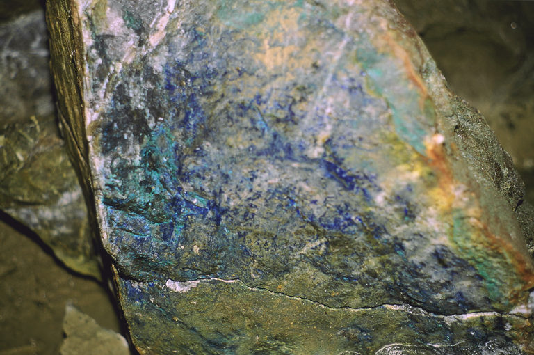
There were numerous large and rich lodes trending toward the northeast, including the upward tapering main Bonanza vein. This wedge was 1900 feet (580 meters) long by 165 to 195 feet (50 to 60 meters) high by 1.5 to 50 feet (0.5 to 15 meters) wide. It alone yielded 720 thousand short tons (653 thousand metric tons) of ore grading 13% copper, and contained 15 short tons (14 metric tons) of silver. Near the base of the Jumbo vein was a single massive body of nearly pure chalcocite (chemical formula Cu2S, 80% copper by weight) measuring 325 by 65 by 50 feet (100 by 20 by 15 meters). Ores included carbonates malachite and azurite, sulfates covellite and chalcosite (sometimes also diginite), and native copper.
The Kennecott Mines Company was formed in 1906, with backing from J.P. Morgan and the Guggenheims, and later become the Kennecott Copper Corporation (both names containing a misspelling of "Kennicott"). The 14 story mill was assembled in 1907 from precut lumber brought in using horses, since there was then still no railroad. Between 1908 and 1911, Michael J. Heney headed construction of the Copper River and Northwestern Railway, stretching 196 miles (314 kilometers) between Kennicott and Cordova. Aerial tramlines carried ore from the mines to the mill for processing. Concentrate went by train from the mill to port, then was shipped by the Alaska Steamship Company to Tacoma (Washington) for smelting.
Some ore was so pure that no processing was required; but otherwise ore was concentrated by crushing, flotation, and leaching. The ammonia leaching process was refined and first used commercially on site at Kennicott. Over the lifetime of the mines, the ore averaged nearly 13% copper! By late 1938, when the mines closed and the last train headed south, over 591 thousand short tons (536 thousand metric tons) of copper and about 110 short tons (100 metric tons) of silver were produced. There were five mine sites (Mother Lode, Bonanza, Glacier, Jumbo, and Erie), and the length of underground tunnels reached 70 miles. The economic value of the copper exceeded that of all the gold in the Yukon Gold Rush!
During the summer of 1977, Joe Head was working for the Bureau of Mines doing mineral exploration in the Wrangell Mountains near McCarthy. Every day, to and from fieldwork, the helicopter would fly him by some cliffs where he could see a fair sized stream emerging from a hole 35 feet (11 meters) up from the base. One day he requested the pilot to drop him off somewhere so he could follow the stream up to its source, a picturesque waterfall emerging from a five sided star shaped cave. He climbed partway up the cliff and reached a connecting entrance, but was unable to squeeze into the main stream passage. He named the cave Dark Star, the title of a Grateful Dead song, but didn't get in to explore it for another seven years.
After the field season was over, Joe mentioned the cave to members of the Glacier Grotto. By the next year a team was organized, including Julius (Jay) Rockwell Jr., Rich and Liz Hall (all from Anchorage), and Harvey Bowers (from Wasilla). In August they flew in, landing on a nearby river gravel bar, explored the area, visited some caves, but failed to get into Dark Star. Two years later, in August of 1980, Jay and Rich returned with Bob Bastasz and Kathy Tonnesson (from California). They visited the resurgence known as Lime Springs, discovered some new caves, including Whispering Cave, but were once again unable to enter Dark Star.
During 1983 while living in Fairbanks, Joe Head mentioned the discovery to Jim Nicholls, a caver who had just moved north from Tennessee the year before. The two practiced rope techniques and got organized in anticipation of an expedition during summer of the next year. Meanwhile, several southcentral Alaskan teams started planning for trips to the area within the same 1984 time frame. The first team to reach the area was a pair of pilots (and climbers), Jeff Bennett and Jim Remele, who spotted the waterfall entrance as they flew by. They landed, hiked up to the cave, rigged the waterfall entrance, and explored the cold stream passage.
In August, Jim Nicholls and his girlfriend Alyson Walker accompanied Joe Head on his return to Dark Star, driving to Glennallen for a Cessna 206 flight to the Wrangells Mountains. At the small airport they met the fourth member of their party, Julius (Jay) Rockwell Jr., who was returning for his third visit. They arrived at the base of the mountain, shuttled gear to the waterfall, set up camp, and surveyed the main and side passages to the sumps. The cave is about 1000 feet (300 meters) of mostly stream passage, with water running about 1 foot (0.3 meters) deep at a temperature only slightly above the freezing point.
Three more groups were scheduled that summer, each arriving a week apart to cut costs by reducing flights (the same plane bringing the next group in would take the previous group out). I arrived in the third group, along with Ray Burger, Scott Maki, and Dan Flood. We entered and explored Dark Star, and also spent time searching farther along the base of the cliffs, finding and surveying a number of other caves. The fourth group dropped out. The final group, staying over Labor Day weekend, included Mike Mauser, Harvey Bowers, Rich Hall, and David Street. They spent most of their time getting to a huge entrance they saw from the valley floor, only to find it was just a giant frost pocket. It had also been entered by others before, since red survey tape was found at the back. They named it "Big Disappointment".
After the initial flurry of activity in 1984, the Wrangell Mountains were pretty much forgotten about for many years. I returned to Dark Star and to reconnoiter more of the mountain beyond in 1991 with two cavers from Czechoslovakia, Leo Saki Zak and Pavel Lojza Jirasek. Months after the trip, when comparing photographs of the cave entrance taken from the trips seven years apart, I made a startling discovery. A very large, multiple ton boulder, which was in place under the entrance lip in 1984, was lying in the stream under the waterfall in 1991!
During every summer, starting with the 1991 trip, I've spent at least a week (often two) on at least one ridge (sometimes more) searching for, exploring, and surveying caves. I've checked out many different ridges, cliffs, streams, and valleys during all those trips, and I've found a number of different caves and shelters, some on every ridge and valley. There are many frost pockets, but there are also a number of solution caves, though only a few are over 100 feet (30 meters) in length.
A number of different people have joined me on these explorations over the years, some hikers and some cavers. But the only two cavers to have joined me more than once were Jim Nicholls and Mike Mauser. In all our explorations within the Wrangell Mountains, we've never noticed any human artifacts or cultural evidence of any kind (not even charcoal) in any of the caves we've visited. We have, however, at a number of different locations, stumbled across mine prospects or manmade shafts with mining tools or equipment.
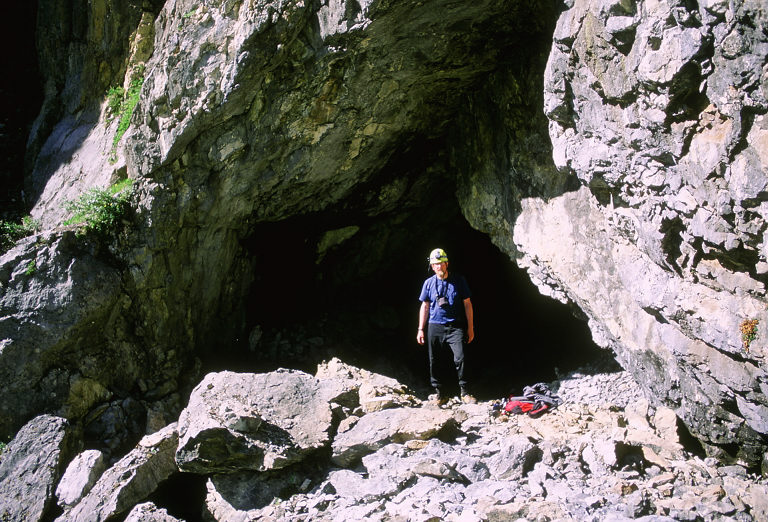
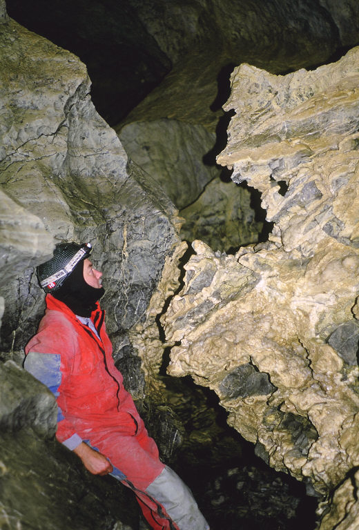
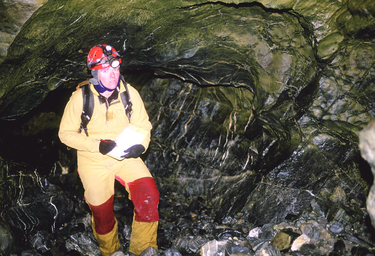
In July of 2002, a hiker friend of mine, James Larabee (from Anchorage), joined me on a photography trip to a location we had never been before, hoping to get some nice shots of mountain scenery. We ended up hiking through a valley with numerous small springs emerging from cracks or holes in the valley walls. Above one collection of half a dozen springs was a large entrance appearing to be a frost pocket (Fig. 2). Closer inspection revealed a solution crawlway continuing beyond the entrance chamber, so we got out our headlamps and took a quick look. We explored about 1000 feet (300 meters) of solution passage, with a small stream running along a section of it. But since this was a hiking trip, not a caving trip, we had no surveying instruments and would have to return later with proper gear for complete exploration.
We did notice a broken formation placed on a shelf near the end of the dry section of the cave. Although we could not determine whether a human had broken the formation off, it was certain that someone had placed it on the shelf. So we knew we were not the first people to enter at least that portion of the cave. Since local residents often fly to places around the Wrangell Mountains to explore, there was a good chance that someone would have spotted the cave simply from walking close by, as we had. As it turns out, we eventually talked to a local who had entered the cave back in 1973, and has been visiting it almost annually ever since. And since so much prospecting had taken place everywhere in the Wrangell Mountains a century ago, it would be foolish to think that none of these men had ever been inside the cave as well.
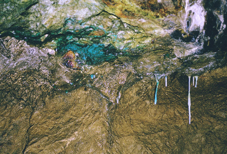
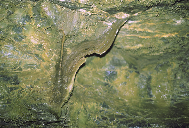
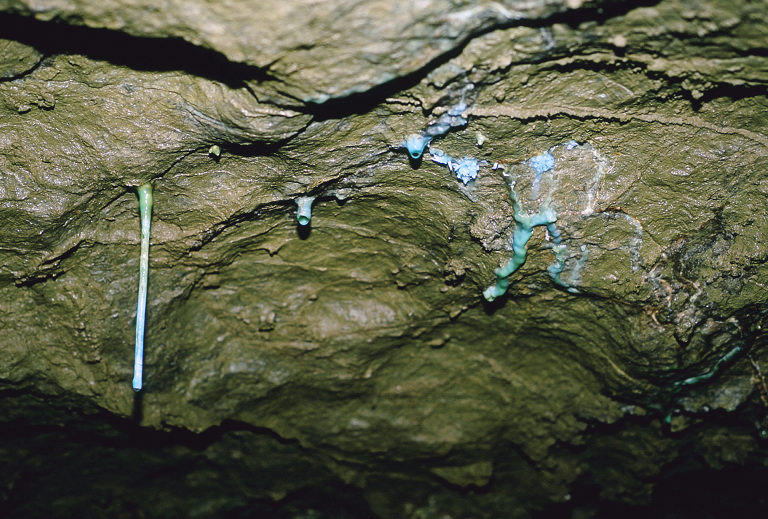
In early September of 2002, I returned to the area with Jim Nicholls and Andi Hunter (both from Fairbanks), armed with ropes and surveying instruments. We spent most of a week exploring and surveying about a third of a mile (half a kilometer) of passage, as well as photographing crystals and speleothems. The most unusual features we saw were the bluegreen formations, the color certainly due to some form of copper. We finished several dry sections, pushed some wet passages to their sumps, and left several good pool and crawl leads.
Jim Nicholls and I returned in September a year later, accompanied by Mike Mauser (then living in Nevada). When we reached the pool lead with the delicate formations, the water was gone. We finished surveying the room, but it only continued another half dozen body lengths. At the other pool lead, we were able to remove rocks and drain enough water to comfortably go on. We entered a high room with a 50-foot (15-meter) vertical wall and some climbing leads. We explored one of the crawl leads until it went into a chimney climb, then left it for another visit. We also left several nasty slick muddy slides dropping into tight water leads.
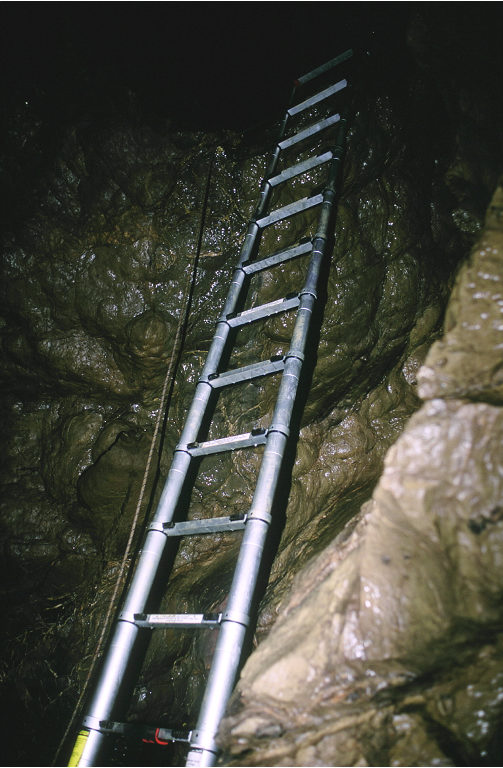
The next year, September of 2004, Jim Nicholls and I returned with a 12.5-foot (3.8-meter) telescoping ladder which fit nicely in a backpack and as baggage in the Super Cub. With it we were able to quickly check a few small chimney leads, and we saved time daily by using it to climb out of the well when exploring up the major crawlway lead beyond. This lead eventually led to a large room above the high wall past the drained pool. Beyond this room were two pools of water and some continuing passage in two directions, but we left this for the next trip.
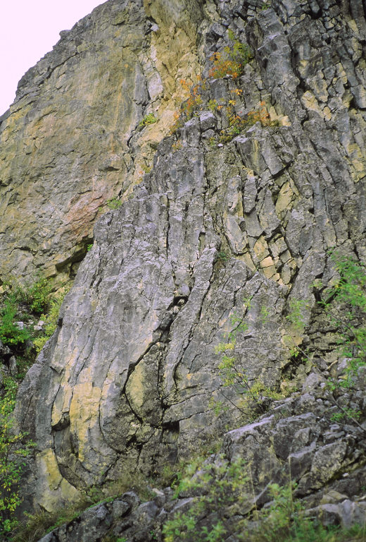
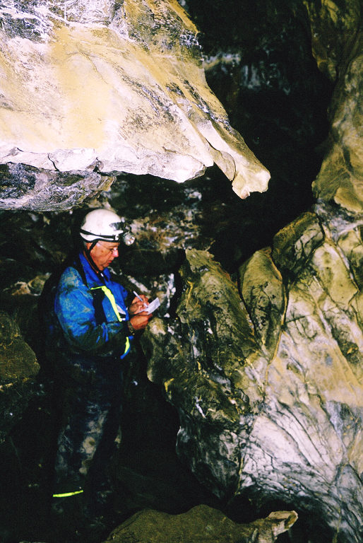
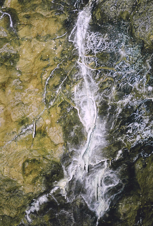
The next visit didn't happen for two years, September of 2006, when Jim Nicholls and I returned again, this time accompanied by Sam Dunaway (originally from Tennessee, now living in Virginia). (Sam and I had explored limestone caves and lava tubes together in Alaska a number of times during the 1990s when he lived in Anchorage.) The three of us explored both of the branches beyond the pools, one ending in breakdown and the other yielding pit leads, including one at the far end of the survey. As usual, I took more photographs of the cave, but Sam and I also noted some of the local geology, such as the contact, faulting, and folding (Fig. 3).
Jim and I returned again this past September, accompanied by Jason Ballensky (California) and Ben Sainsbury (Washington). Jason rigged the remaining pit leads, including the far lead which we all dropped on the first day. Since there were four of us, I used the next day to tie up loose ends in my documentation of formations while the others continued with the survey. The cave continued in water passage and eventually sumped, so it happened to be our last day. The group heard some sort of loud jetlike noise coming from somewhere near the end of the cave. It would occur occasionally, seemed to last well over a minute, and just freaked everyone out. Their descriptions varied and, unfortunately, in all the excitement, no one recorded the sound. I asked whether the sound varied in frequency or only in amplitude, but there was no consensus. It appeared to be water or air pressure related, though there was no noticeable disturbance in the pools. However, concerned with potential flooding, everyone was glad to get out of there!
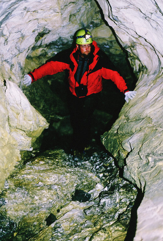
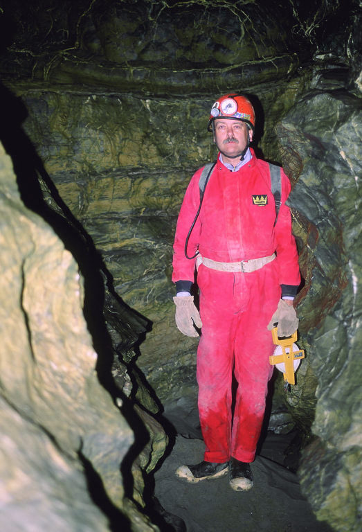
What one must understand about caving in Alaska is the remoteness, which not only affects trip logistics (the time and effort for getting there and back), but also complicates rescue. For us to get to the Wrangell Mountains, we had to drive paved roads to Chitina, 315 miles (500 kilometers) from Anchorage or 375 miles (600 kilometers) from Fairbanks. From Chitina we drove another 60 miles (100 kilometers) of fairly bad gravel road to the Kennicott River, the end of the road--still over half a mile (a kilometer) from the town of McCarthy. We then crossed the footbridge over the roaring Kennicott River, at the toe of the Kennicott Glacier, to catch a shuttle bus ride to our air taxi service and then the airport, where we met our pilot.
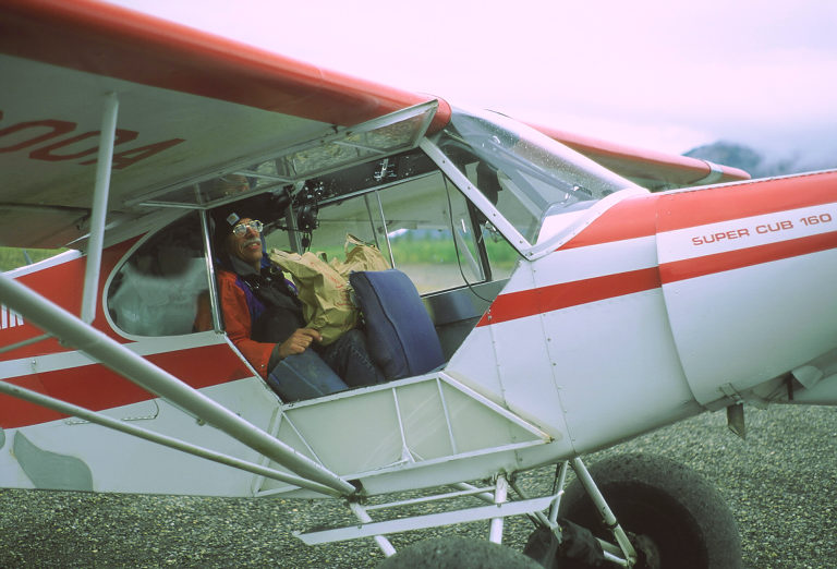
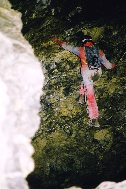
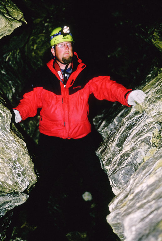
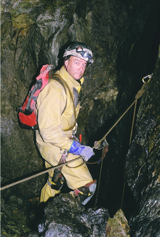
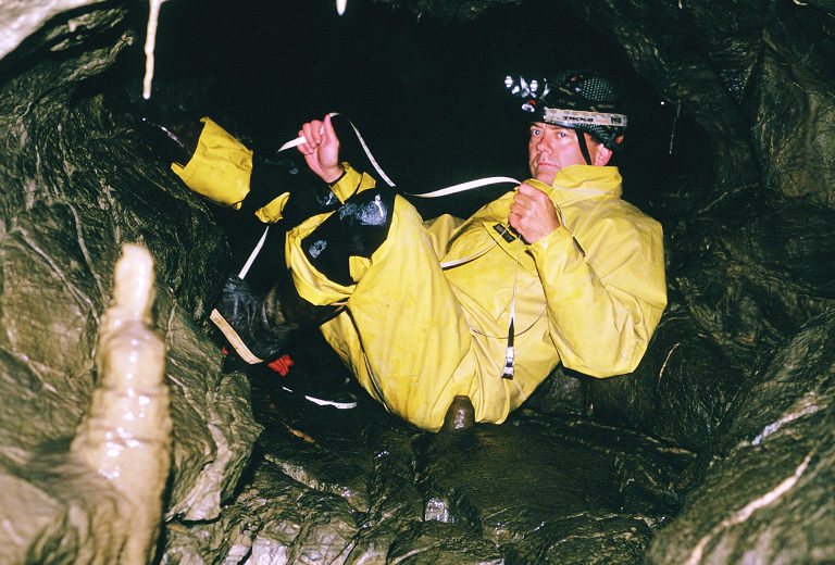
Our aircraft was a Super Cub 160, a small Piper Cub with improvements to give it more power and maneuverability for short takeoffs and landings on remote river bars or alpine tundra. These planes are small--there were pterosaurs during the Cretaceous with greater wingspans! We boarded one person with gear at a time (Fig. 4) for our short hop through the mountains and across glacier streams to the remote airstrip. Then we shuttled gear and set up base camp at a reasonable place between the airstrip and the cave entrance.
As mentioned before, strange loud sounds were heard from the final room, probably due to large air or water pressure differences nearby. Though no water movement or flooding was observed, it is advised that visitors beware of possible violent flooding. The cave appears affected by both surface streams (due to rainfall) and glacial meltwater (due to sunlight), with these options independently delayed with unknown lag times, probably measured in days.
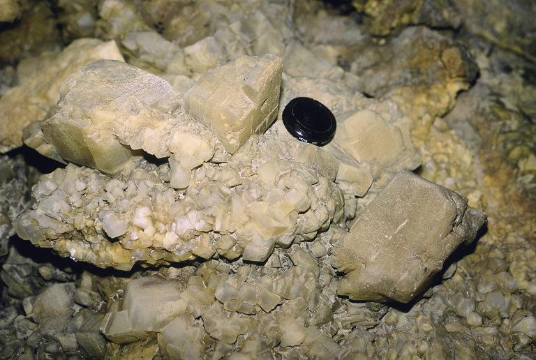
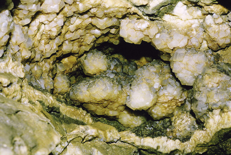
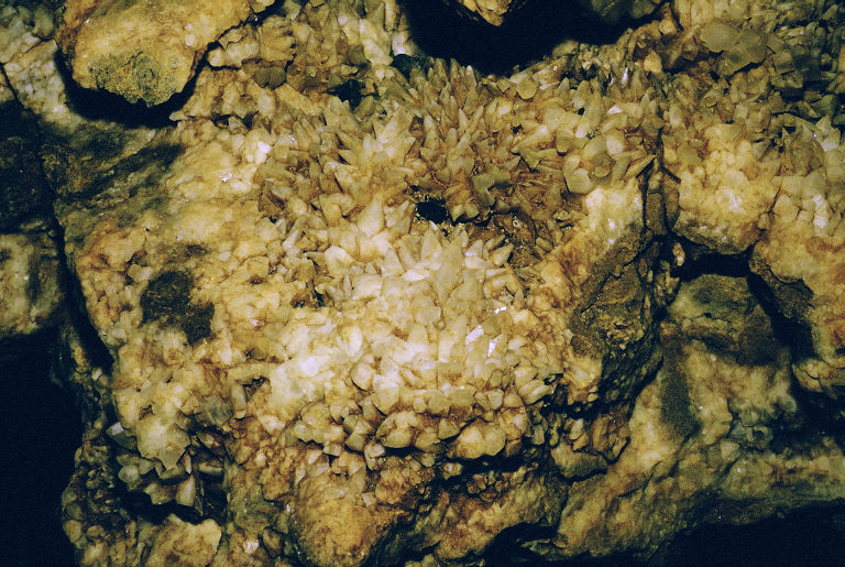
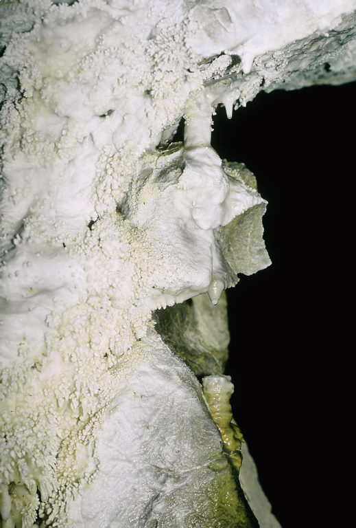
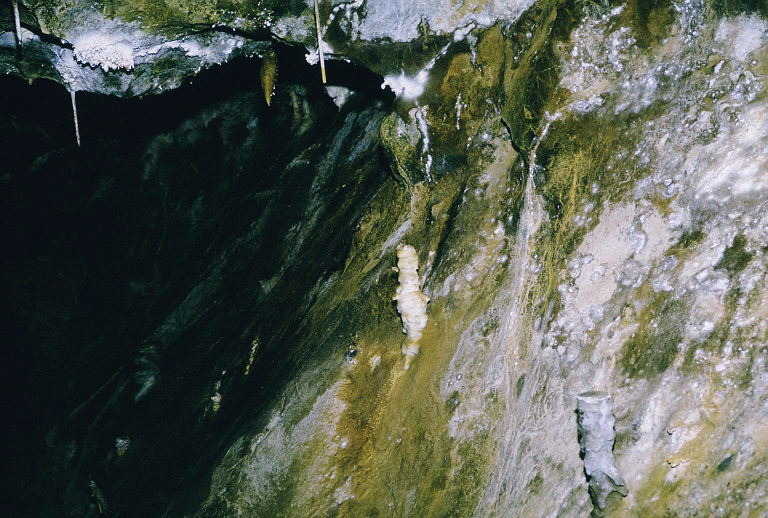
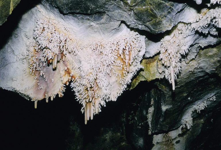
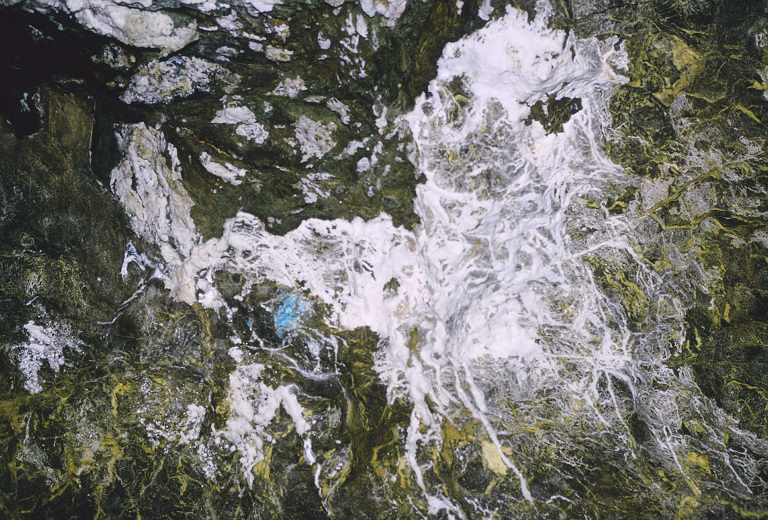
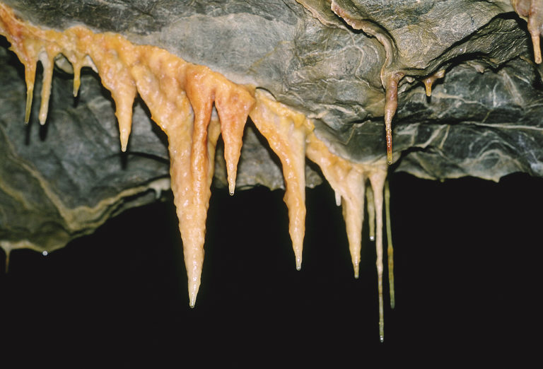
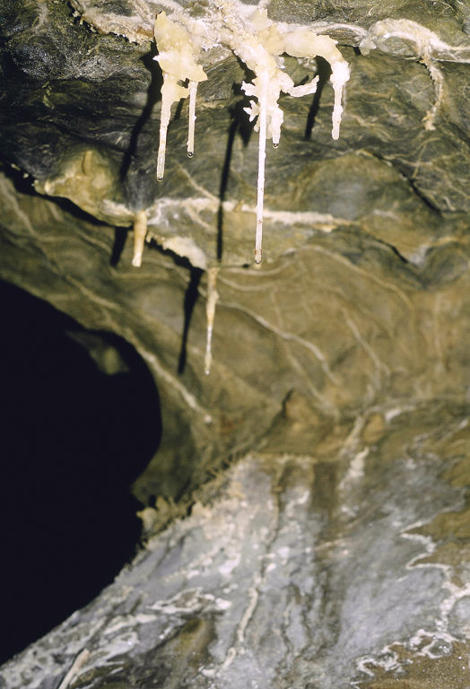
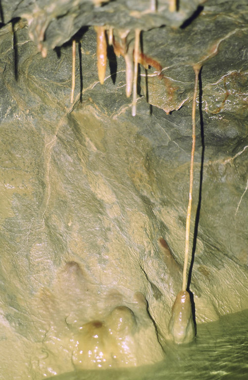
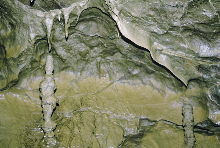
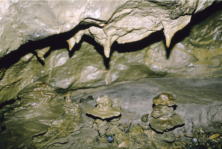
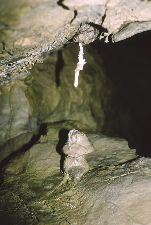
Leprechaun Cave begins with an oval entrance room above a dry streambed, its size being about 40x30x10 feet (12x9x3 meters) and slanting upward, heading north at the back. From the back a crawlway 3 feet (1 meter) high leads into the cave and soon opens up into a high fluted walkway, with calcite crystals up to 5 inches (12 centimeters) in size lining the sides (Fig. A) and appearing in broken plates on the floor. Soon the walkway drops into a shallow climbable pit with rounded cobbles on its floor. In the low stoopway after climbing out of the pit (Fig. B), the crystals become more plentiful for a short while. They are mostly the rhombohedral form (Fig. C), but occasionally dogtooth spar (Fig. D) is also present.
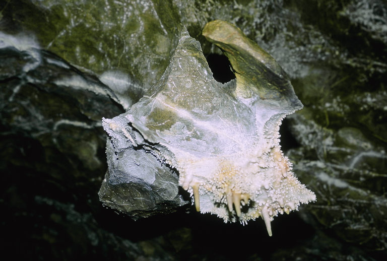
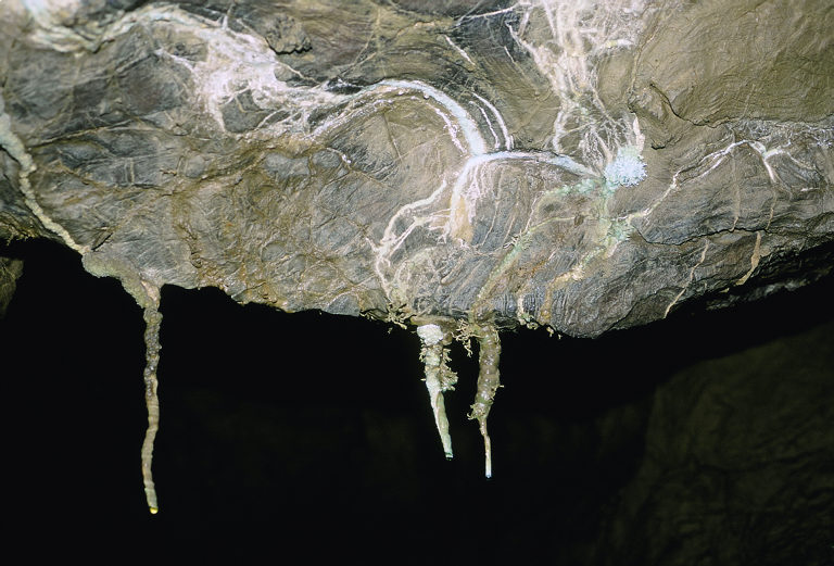
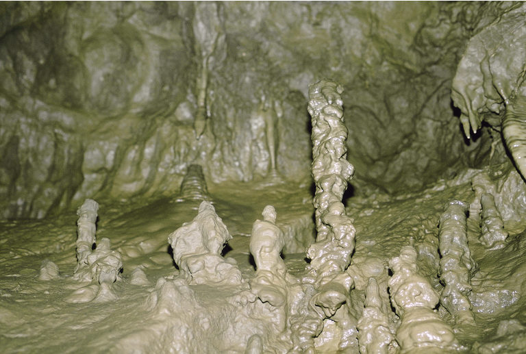
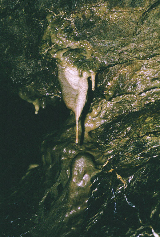
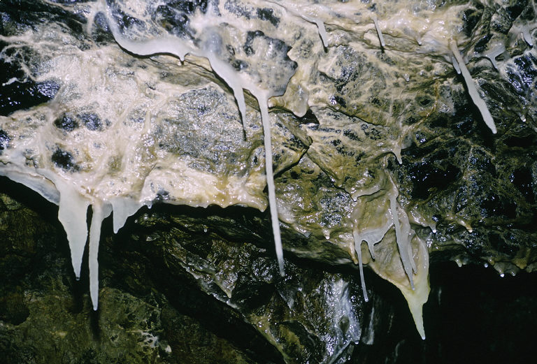
Then the ceiling rises to 20 feet (6 meters), there is some calcite boxwork (Fig. E), and finally the walls turn to a swirl of black and white (Fig. F). Soon an upper shelf opens up into a large room with passages leading off to either side and white spots on the ceiling. Going right (east), passing through a keyhole, the high walkway (Fig. G) becomes a low walkway with a dusty floor. One corner is covered in white flowstone, nicely decorated with cave coral and a vertical sequence of speleothems (Fig. H). This section of the cave was named Candlestick Passage, due to the candle shaped stalagmites which frequent the right side (Fig. I). Just beyond is a junction and a chandelier, an odd shaped fin of limestone decorated with small stalactites and cave coral (Fig. J).
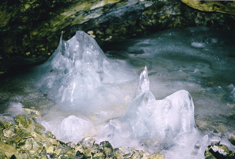
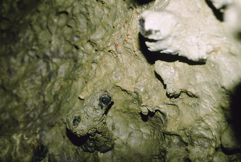
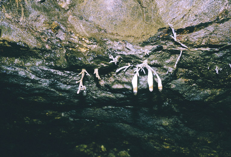
Going right (south), a low walkway with a washed floor (Fig. K) heads downward, ending in a small room with ice stalagmites (Fig. L). Going left (north),another low walkway continues, its walls decorated with small stalactites and cave coral resembling miniature inverted mountain scenes (Fig. M). A short side stoopway heads left (east), also decorated with cave coral, and ends in a tight room with numerous black chert nodules sticking out of the limestone in relief (Fig. N). The low walkway eventually drops into a large, climbable, funnel shaped pit, then narrows into a tight crawlway. Numerous dead insects stick to moonmilk at the bottom (Fig. O). This sidebranch goes into a small room with a narrow slot floor, and finally drops into a super slick muddy sloping pit.
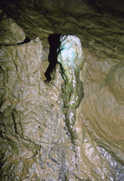
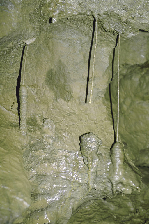
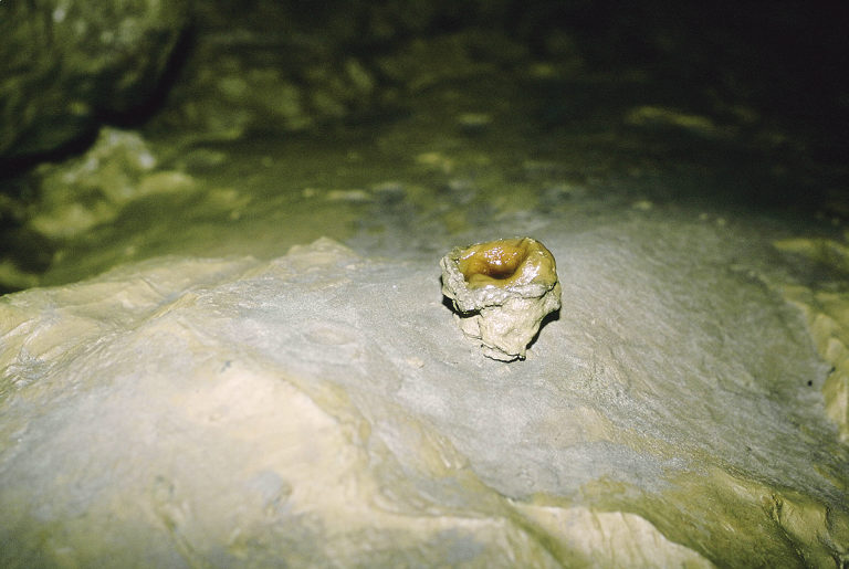
Going left back at the large junction room, more spots are present on the ceiling and walls, the colors including white, light green (Fig. P), bluegreen (cyan), and brown (Fig. Q). The high walkway trends right (north), then turns left (west) with a split continuing straight (north). This side spur goes into a belly crawl, then opens up into a pool which is sometimes dry (Fig. R), and has a cemented pebble floor. Near the edge of the pool lies a boulder of blue copper ore (azurite and perhaps bornite) (Fig. S). Deep bluegreen (cyan) formations and spots color the walls (Fig. T). The pool swings left then right and ends, but some nice formations mark the way, such as pointed brown and orange stalactites (Fig. U), translucent inverted candelabra (Fig. V), and a soda straw 3 feet (1 meter) long (Fig. W).
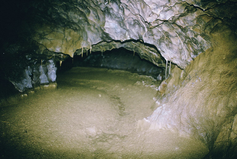
The main passage soon splits, and the left (south) branch heads downward. It begins as a high walkway with a sandy floor (Fig. X), but gradually gets shorter until it becomes a low walkway with a cobble floor (Fig. Y). Speleothems are few, such as a redissolving ribbon (Fig. Z), and the few high leads all pinch out. The ceiling continues to lower until the stoopway slowly dips into cold water (Fig. aa). A right (west) side branch just before the end leads to a room with a dome climb and a pool which can be drained. Beyond this a portal leads to a 50-foot (15-meter) wall and a vertical lead to be connected later.
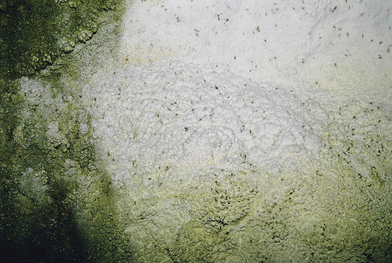
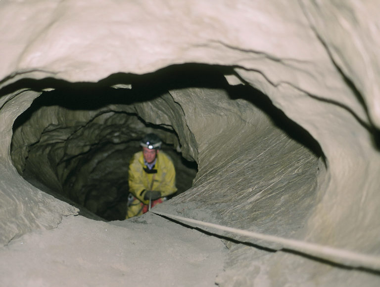
Returning to the main passage, the right (north) branch twists and turns around some limestone fins, then opens up into a high walkway with the floor alternating between sand and pebbles. Sometimes, depending on the water table, a small stream flows alongside this section of the cave. The high walkway winds around for 200 feet (60 meters) with a few tight ceiling leads, passes through a keyhole (Fig. bb), and enters The White Room, where rocks are partially encrusted in a strange white powder (Fig. cc). Here the ceiling lowers, so the high walkway becomes a low stoopway over angular boulders. Then it makes a left (west) turn and goes another 100 feet (30 meters).
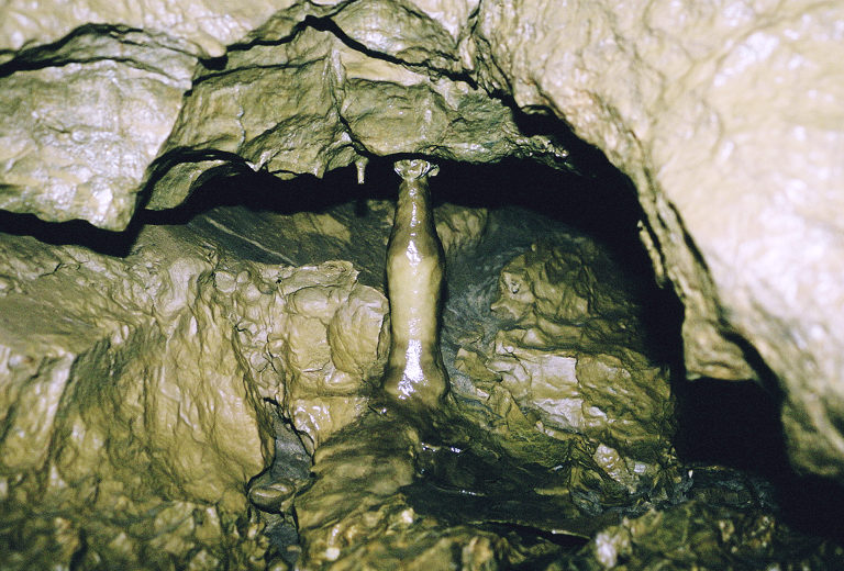
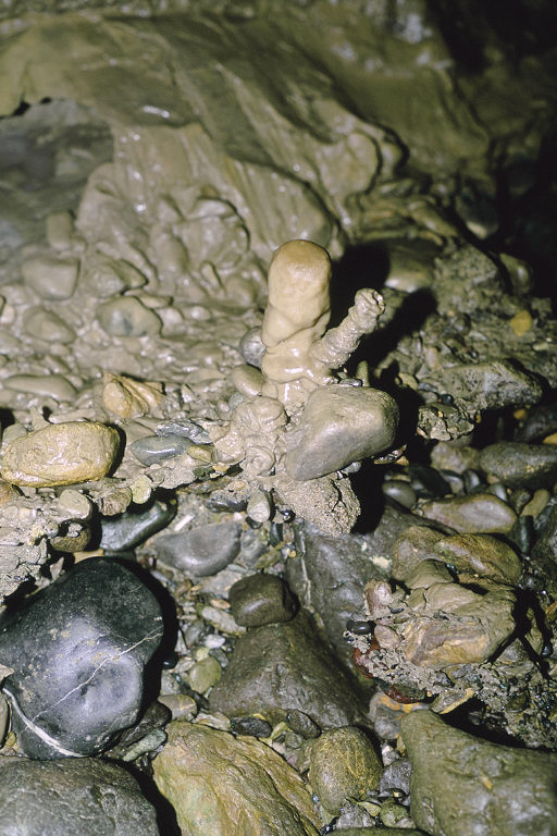
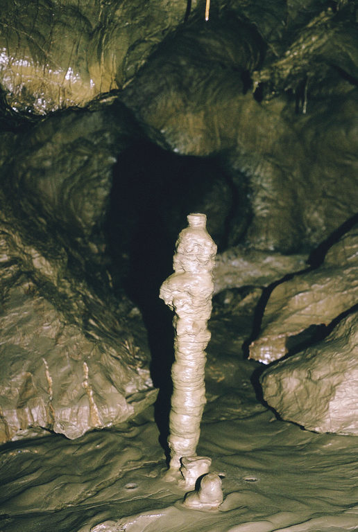
A series of bluegreen (cyan) formations, including a soda straw (Fig. dd), a stalagmite (Fig. ee), a stalactite, and a delicate helictite (Fig. ff), appear just before a drop-off and left (south) turn. Making the turn and heading downhill, the low walkway becomes a high walkway with tight leads both high and low, although nothing seemed to go. But formations abound, mostly in a muddy brown color, but varying in shape: wedges, carrots, knobs, statues, ribbons (Fig. gg), figurines (Fig. hh), long soda straws (Fig. ii), a splash cup (Fig. jj), and even a soda bottle (Fig. kk). Eventually, the high walkway becomes a low stoopway, and the floor appears to be washed out from a long ago cemented pebble floor with some formations barely hanging on: a pipe (Fig. ll), lily pads (Fig. mm), and The Leprechaun (Fig. nn).
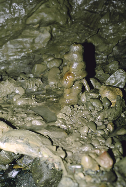
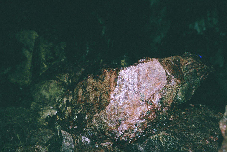
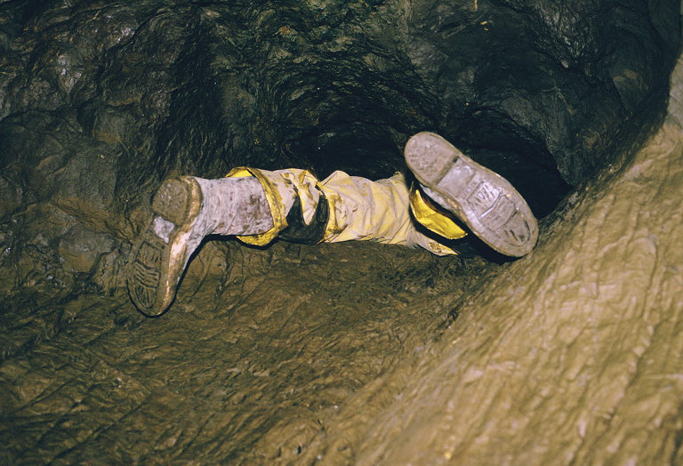
The stoopway becomes a crawlway, closes down to a belly crawl, then opens up again to a crawlway leading into the bottom of a shallow well. Though the belly crawl continues, it gets too miserable to follow. But to the right (west), after a short ladder climb (Fig. oo), a long crawlway heads up at an angle, makes a turn left (south), then splits in two. The right (west) branch crosses some potholes near a mushroom stalagmite (Fig. pp), passes a short side crawlway with a striped formation (Fig. qq) and a triple pronged helictite (Fig. rr), and leads to a breakdown room to be connected later. The left (east) branch turns right (south) and leads to The Red Room, a large multilevel room containing many red boulders (Fig. ss). The rocks here are neither limestone nor greenstone, but appear to be in some sort of contact or fault zone.
The room slopes steadily upward, with a side room down to the left and another lead up in the opposite direction. Taking the left (east) direction leads into a smaller room and a pit (Fig. tt) connecting to the vertical lead at the tall wall and drained pool. Going the other way (west) leads to the breakdown room just mentioned, and another 100 feet (30 meters) leads to The Wading Pool. A small helictite above the pool twists toward the opposite side, where a climb-up leads to a high walkway with more breakdown and some translucent (almost clear) stalactites (Fig. uu). Past these is a side walkway left (south) leading through a swimming pool (Fig. vv) and into a large breakdown maze.
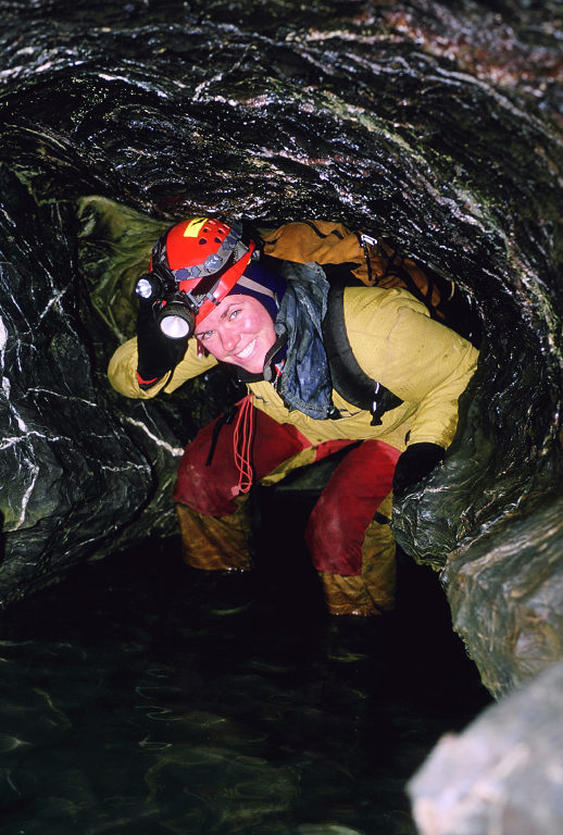
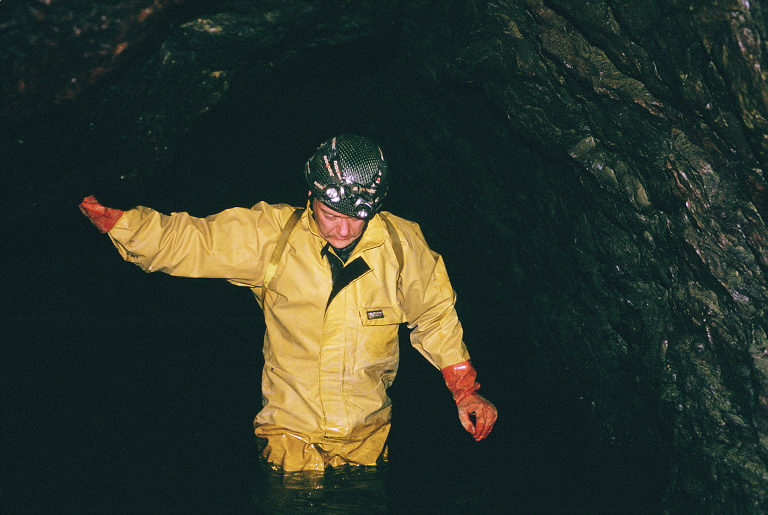
Continuing on the main passage, the walkway becomes a small tubular crawlway (Fig. ww) for 200 feet (60 meters), with an occasional muddy brown speleothem (Fig. xx) and numerous side tubes too tight to follow. A couple of steeply sloping shafts (Fig. yy) drop down 35 feet (11 meters) to the right (north) but join together in a sump. Slightly farther, a climb-up to a belly crawl (Fig. zz) leads on to a 15-foot (4.5-meter) climbable pit, followed by a 50-foot (15-meter) steeply sloping shaft, and finally a 20-foot (6-meter) free drop into a large room along water passage. One direction immediately sumps, and the other, heading right (north), goes only a short distance before leading into another swimming pool. For the remainder of the exploration, cold water is only temporarily avoidable.
About 100 feet (30 meters) of swimming is followed by about 300 feet (90 meters) of walking borehole, then a pool and a turn left (west). After a room with a high dome ceiling, the high walkway turns right (north), then slowly heads back left (west), passes a side sump, and heads into another swimming pool. This pool can be avoided, however, by taking a high climb around it. After another 200 feet (60 meters), the cave ends as a sump in a room with twin domes. The total surveyed passage length is over a mile, at 5443 feet (1659 meters).
Davis, Donald G., 1996, Alaska Visions: Impressions from a Northern Expedition: NSS News 54(8), p. 213-218.
Mats, George, 1999, World Heritage Wilderness (from the Wrangells to Glacier Bay): Alaska Geographic 26(2), 112 p.
Simpson, Ronald N., 2001, Legacy of the Chief: Publication Consultants, 800 p.
Winkler, Gary R., 2000, A Geologic Guide to Wrangell-Saint Elias National Park and Preserve, Alaska (A Tectonic Collage of Northbound Terranes): U.S. Geological Survey Professional Paper 1616, 166 p.